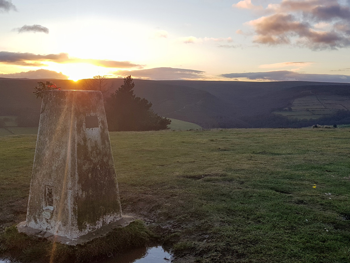
My latest Peak Challenge walk was inspired by a photo that I took on Christmas Eve 2020 from the trig point on Whitwell Moor, near Stocksbridge. The image quality isn’t the best, but the valley you can see in the background is Ewden Beck. It looked picturesque, and walk-round-able, so I decided to make it my next walk.
I had decided that my next Peak Challenge walk would be a big one, so I picked a big area I’d not walked before. I had driven along Mortimer Road many times but never found the view across Derwent Moor to be particularly enticing. At least today’s covering of snow made it look slightly prettier and a bit less bleak! This was a varied day, and there were times when I was alone in the fog with barely a tuft of heather sticking up above the snow, and there were other times when I was surrounded by families out on their Saturday walk. I was glad to have finally explored this area, and I think I picked a great day to do it.
The second (ish) of my Peak Challenge walks was completed with my brother on a cold December day. It passed through 6 grid squares but only netted me 3 new ones, as I’d done a couple of sections before. Despite that, it didn’t feel repetitive, as the challenging weather and good company made it an enjoyable walk.
The first of my Peak Challenge walks was close to home, and allowed me to tick off 8 new grid squares. An exploration of the moorland above Midhope and Langsett Reservoirs, taking in Pike Low and Mickleden Edge.
I really enjoyed this walk, because although the area looks empty on the map, and bleak at first sight, in reality it’s packed with interesting features.
I’m lucky to live right on the edge of the Peak District, but despite that, when I’m planning a trip, I always feel the urge to travel to the Dales, the Lakes or Snowdonia. I feel like I’ve “done” the Peak District, but really I know that isn’t remotely true.
To give me ideas for new areas to visit, I’ve decided to visit every single 1km2 grid square within a defined area of the Dark Peak. I’m calling it my “Peak Challenge”.