Mapping Software Comparison: Editing and Saving Routes
- Posted
- Modified
- Author Sam
- Categories Mapping Software Comparison
- Comments 1
So far we have covered viewing maps, searching the map and viewing other people’s routes. But the chances are that you also want to create your own routes, and work with your own tracks, waypoints and areas.
Basic features
All of the software supports routes, but not every system supports tracks, waypoints and areas. If you’re not familiar with these concepts, here’s how I think of them:
- Waypoints are “points of interest” not linked together by a route. I use waypoints to mark aircraft crash sites, good wild camping spots, and the like.
- Routes represent your plans, intentions, or ideas. They are a line on the map that was drawn by you, or somebody else, from their armchair.
- Tracks represent actual data collected by somebody who was there “on the ground” at a specific point in time. Because they are time-based, you can see when you were at a point, and how fast you were travelling. Tracks are usually generated using GPS devices.
- Areas are similar to routes, but start and end at the same place. You need to know where the boundary is but not because you would follow it as a route. I use areas to show the various DofE Wild Country areas, so I can tell when routes enter and exit the defined area.
| Editing | Anquet OMN | Mapyx Quo | Memory-Map | OS Maps | RouteBuddy | ViewRanger |
|---|---|---|---|---|---|---|
| Waypoints | Edit | Edit | Edit | No | Edit | No |
| Routes | Edit | Edit | Edit | Edit | Edit | Edit |
| Tracks | Yes (read below) | Edit | Read-only | Imported as route | Read-only | Imported as route |
| Areas | No | Yes | Yes | No | No | No |
All the software covered supports editing routes, including adding, removing and moving points.
Anquet, OS Maps and ViewRanger let you can import GPX files with tracks in them, but they are imported as routes and the track-specific data including date, time and speed information is not visible.
Memory-Map and RouteBuddy do distinguish between routes and tracks. They let yet you view date/time and speed information for tracks, but don’t let you edit them. This is not a problem to me, as editing a track means that the date/time information becomes inaccurate and meaningless, so I’m quite happy with being forced to copy a track to a new route before being allowed to edit it.
Only the web-based providers, OS Maps and ViewRanger lack support for waypoints, probably because they only display 1 layer at a time, and waypoints aren’t very useful by themselves, and are generally used to show “supporting information” for planning a route (eg. aircraft crash sites, camping spots, etc.) Note that OS Maps allows you to name points along your route, and it calls these “waypoints”, but that’s a slightly different concept.
Mapyx Quo is the only provider with full support for waypoints, routes, tracks and areas. The detailed “Point Grid” lets you edit any attribute of any point. It seems superfluous until you need to use it, then you take it for granted, until you switch to another product that doesn’t give you this level of control. That being said, it can be intimidating for new users if you don’t know what you’re looking at.


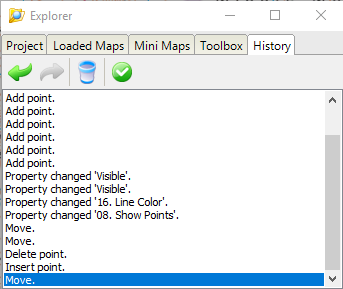
Undo
Undo is a big enough deal to get its own section. Not because you can’t work around it, but because you shouldn’t have to work around it in 2021.
Providers that don’t support a fully-fledged Undo feature usually tell you to duplicate your route, or save a backup of your overlay file, before making any major changes.
Anquet is the only provider without any kind of undo feature. To be fair, the creators acknowledge it as a gap, and a post on their customer forum shows that they have plans to implement it soon.
OS Maps will undo changes to the location of points on your route, won’t undo other types of changes, so if you accidentally mislabel one of your points as “lunch stop” and then click “undo”, your incorrect label will remain but the last point you moved will be moved back.
Mapyx and Memory-Map have the best undo features that are able to undo any type of change. Memory-Map only lets you go back 10 steps, but on Mapyx you can undo right back to the last time you opened the software, regardless of how much you’ve done since then. If there’s a limit, I’ve not encountered it.
| Undo | Anquet OMN | Mapyx Quo | Memory-Map | OS Maps | RouteBuddy | ViewRanger |
|---|---|---|---|---|---|---|
| Undo route change (line of route) | No | Yes (20+) | Yes (10) | Yes (20+) | Yes (until end route) | Yes (20) |
| Undo route detail change (point name, description, etc.) | No | Yes | Yes | No | No | Yes |
| Undo route add/delete | No | Yes | Yes | No | No | No |
Advanced features
I couldn’t come up with a better name for this section, but “advanced features” covers things like reversing, splitting and joining routes, as well as snapping routes to the path.
Reversing, splitting and joining routes are useful when you need them, but there’s not much to say about these features other than to show a comparison table of which system supports each operation.
| Advanced | Anquet OMN | Mapyx Quo | Memory-Map | OS Maps | RouteBuddy | ViewRanger |
|---|---|---|---|---|---|---|
| Reverse routes | No | Yes | Yes | No | Yes | Yes |
| Split routes | No | Yes | Yes | No | Yes | No |
| Join routes | No | Yes | Yes | No | Yes | No |
| Route snap to path | No | No | Yes (10 points max) | Yes (National Parks only) | No | Yes |
Route snapping to a path is much more interesting to me. I don’t use it for route-finding, because it’s rare for me to want to follow the most direct route between two points, as it’s often along a road which doesn’t make for a pleasant walk. Instead, I place regular waypoints to force the route to go “my way”, and I use the snap-to-path feature to draw a neat line that directly follows the path. It’s purely for the tidy appearance, and it doesn’t make any difference to my navigation.
Memory-Map isn’t really compatible with my approach, as it only supports “auto-routing” between up to 10 points. You have to wait until you’ve finished plotting your route before running the “snapping” process.
OS Maps takes a much better approach and will snap your route to the path as you draw it, but the snapping feature only works within National Park boundaries, and only when you’re using the Explorer (1:25K) maps.

I switched to a different base map because the red line was difficult to see against the OS Landranger map.
ViewRanger has the best path-snapping feature of all the systems. It works in all areas, and snaps as you draw the route, with no limit on the number of points you can place.
Storage and organisation
There are a variety of different approaches to storing your routes and other content, and although this is a fairly dry area to explore, it’s probably the factor that will have the biggest impact on the way you use the software. I have tried to put each system into a defined category but there is substantial crossover which the comparison table hides. It’s more of a spectrum, which start with conventional file-based systems, then moves through the systems with an internal database, and finishes with the purely cloud-based systems.
| Storing | Anquet OMN | Mapyx Quo | Memory-Map | OS Maps | RouteBuddy | ViewRanger |
|---|---|---|---|---|---|---|
| Primary storage method (file, internal, cloud) | Internal / Cloud | File | Internal / Cloud | Cloud | Internal | Cloud |
| Organise content into folders | Yes | Yes (and layers) | Yes | No | Yes | No |
| Search for saved routes | No | Yes (find next) | No | Yes (filter) | Yes (filter) | No |
| View saved routes on map | Yes | Yes | Yes | Yes (start point only) | Yes | No |
Mapyx Quo is purely file-based. When you open the application you will start with an empty “project”. You can add routes, tracks, etc. to this project, grouped into folders and layers if you want to, then you save your project using File > Save. The project is saved as a file on your computer, that you could store on your Desktop, My Documents folder, USB drive, Google Drive, and so on. When you want to load the project, you use File > Open to find your project file, which loads all your routes, tracks etc. back into the software.

Memory-Map is slightly different. When you open the application, it automatically loads the last “overlay” you used. “Overlays” are a collection of routes, tracks and waypoints, which can be organised into folders if you want to. You can export the overlay to a conventional file, including GPX, so you can send it to others, but I imagine that many users will just rely on their routes being there when they open the application, in the same place that they left them from last time.

RouteBuddy is similar to Memory-Map but “overlays” are called “place files”. Place files can be organised into folders, but you can’t create folders within a place file. You also can’t export your place file to a conventional file, for example GPX, unless you buy the upgraded version of the software for £39.99.
On RouteBuddy, when you add a route, track or waypoint, as well as being added to the current place file, it is also added to the “library”. This is a database of everything you’ve ever created, and your content will exist here even if you delete it from a place file. One use case for this would be to create a “place file” for each trip, and reuse routes, tracks and waypoints from your general library. Yes, you could do this using GPX files and a folder on your computer if you really wanted to, but having it built into the software is a better user experience, although I can imagine it becoming quite overwhelming if the user doesn’t prune through their library now and then.

Anquet has an internal library that allows you to store your GPX files inside the application. These are synchronised to Anquet’s cloud, meaning that if you use Anquet on different devices, your content will be automatically synchronised. Please note that some of the other systems also support this just for their mobile apps, and this is covered later in this article, but Anquet supports this for the desktop version as well. Items in your library can be hidden easily, so you can show and hide your routes to avoid cluttering the view. When you open the application, it will automatically show you what you were working on last time. You can create folders to organise your GPX files, and they can contain routes, tracks and waypoints as standard.
Anquet has created two concepts for the library. The first is the GPX Manager, that shows all the content stored on your account. The second is the GPX Editor, which only shows content that you have opened. The GPX Manager allows you to organise your GPX files into folders, and the GPX Editor lets you organise the content of your GPX files in terms of routes, tracks and waypoints. To be honest, I prefer Mapyx’s single folder tree that lets you do both jobs at once, and I find the separation a bit confusing.

OS Maps and ViewRanger are both fully cloud-based, and your routes are displayed as a flat list, with no support for folders to organise your content. This is a shame, as it won’t be uncommon for people to have lots of routes, and it doesn’t take long before a flat list starts to become cluttered. This has led to me having to name my routes in specific, coded ways, so I can find them easily. It would be much better if folders were supported.

Filtering content
Once you’ve accumulated lots of routes, tracks and waypoints, it’s useful to have a way of filtering or searching through your content, especially if there’s no way of grouping your content into folders.
Anquet, Memory-Map and ViewRanger have no search feature, although Anquet and Memory-Map both support folders. ViewRanger is web-based so you could use your web browser’s CTRL+F keyboard shortcut to search for a route on the listing page if you needed to.
Mapyx, OS Maps and RouteBuddy all provide a way to search through or filter your content.

Also worth mentioning is that although OS Maps and ViewRanger will only let you view a single route at a time, at least OS Maps will show a marker for the start points of all your routes. This is helpful when you’re trying to choose between several routes that you’ve planned in a specific area.
Export
All the providers offer GPX export as standard, with the exception of RouteBuddy which charges £39.99 for an upgrade that allows you to do this.
Mapyx, Memory-Map and RouteBuddy also support exporting other formats as well, but GPX is now so universal that I rarely have any need to export any other format.
| Export | Anquet OMN | Mapyx Quo | Memory-Map | OS Maps | RouteBuddy | ViewRanger |
|---|---|---|---|---|---|---|
| GPX | Yes | Yes | Yes | Yes | Yes (paid) | Yes |
| Other file formats | No | Yes (lots) | Yes | No | Yes (paid) | No |
Remarks
By having the most comprehensive editing features, and the most powerful tool for organising content into projects, layers and folders, Mapyx is the overall winner for me. The only feature that’s missing is the “snap to path” and that’s not really a big deal for me. Having said that, the variety of options offered in Mapyx can be intimidating for new users, and the support materials could be improved to help with this.
Notable mentions
- Anquet’s hybrid approach combines GPX files and a cloud-based library, meaning your content is available on all your devices straight away, without locking you into a proprietary format. This is a great idea that I’d like to see more providers offer.
- ViewRanger which has the best implementation of the snap-to-path feature.
Areas for improvement
- OS Maps which has no way of organising your routes into folders, and gets cluttered very quickly as a result.
- RouteBuddy which locks your content into a proprietary format unless you pay £39.99 for an upgrade.
Do you agree with my ranking? What features are most important to you? Leave your thoughts in a comment below.